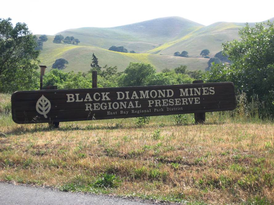
Black Diamond Mines
Thursday, May 29, 2008
Please RSVP to Dennis Ratay by phone (543-9935) or email (Denratay@Sbcglobal.net) as
soon as possible to confirm your participation in this hike. We must ensure a minimum
of 10 hikers to reserve our tour of the Hazel-Atlas sand mine. See below.
DIFFICULTY: Strenuous
ELEVATION GAIN: Approximately 1200 feet with the various climbs and descents - feels like 1400 feet. Highest altitude is 1100 feet.
HIKE DISTANCE: 8.5 miles in a figure 8 loop.
GENERAL LOCATION: Black Diamond Mines Regional Preserve. The trailhead is 3 miles southwest of the town of Antioch.
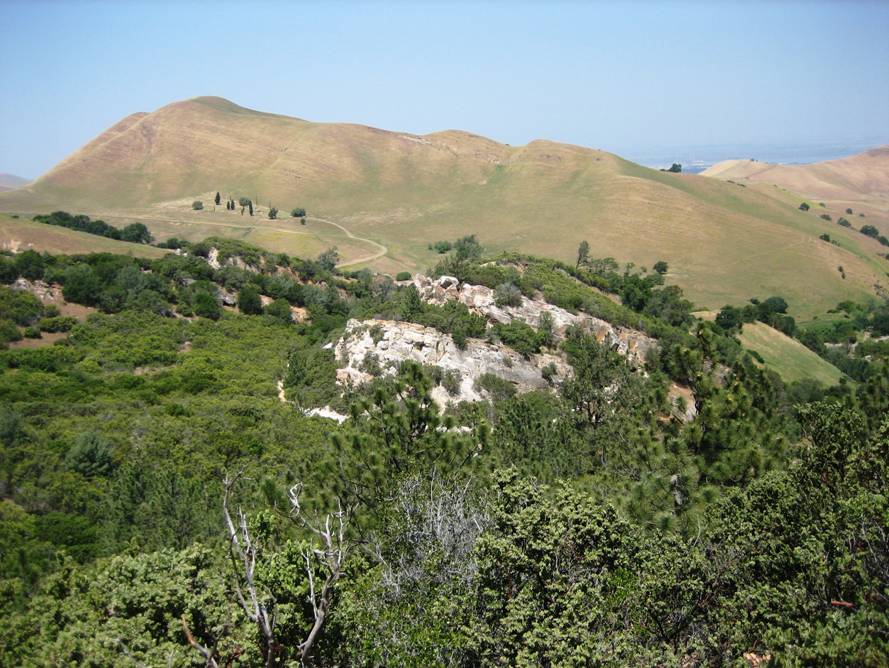
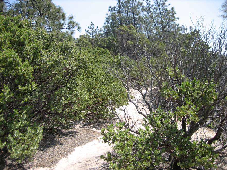
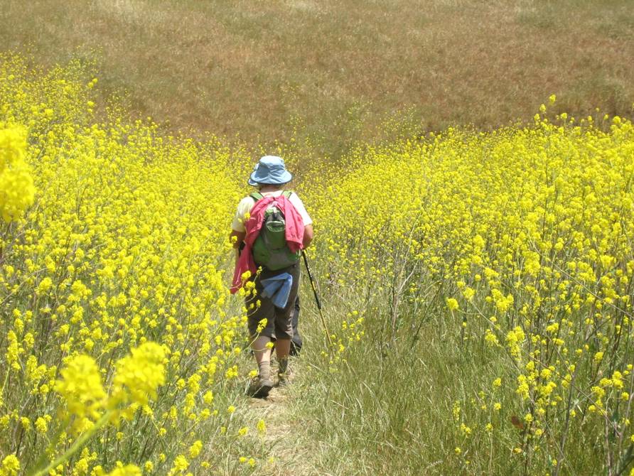
DESCRIPTION: This hike has diversity, diversity and diversity -- a bit of everything. Located in the heart of California’s largest coal mining operation in the late 1800’s, the trails traverse jagged and jumbled ridges, erratically sloped grasslands, and sprawling valleys, all dotted with blue oaks and patches of chaparral. This is a remote land where the prairie falcon soars and the coyote still howls at night, out of the sight and sound of cars and houses. The trail route includes scenic vistas on wide trails to narrow trail descents through Manzanita groves. The rare Coulter pine is included in the diverse native tree and shrub population. While the scenic beauty is awe inspiring, the remaining remnants to the hard life of coal and salt mining over a hundred years ago will leave a lasting impression about these early California pioneers.
Highlights of the hike include:
- A guided naturalist tour of the Hazel-Atlas sand mine. A section of this mine has been restored to appear as it did when the mine was active. We’ll see mining methods, equipment, and tools typical of the 1940s when silica-rich sand was mined for the production of glass products. The tour is scheduled for 1:00 PM and will provide a much welcome break after the more strenuous part of the hike in the morning.
NOTE WELL: WE MUST GUARANTEE A MINIMUM OF 10 HIKERS TO RESERVE THIS GUIDED NATURALIST
TOUR AND BE ABLE TO TOUR THIS SAND MINE. THE COST IS $3.75 PER PERSON. PLEASE RSVP ASAP.
- The historic Rose Hill Cemetery which serves as a monument to the lives of former residents and those who lost their lives in mining accidents.
- Views of Mt. Diablo
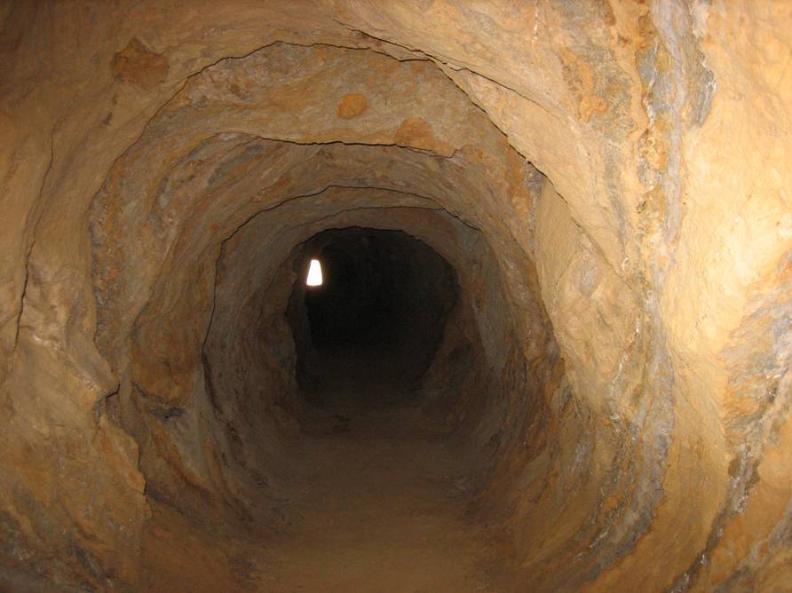
- A 200 foot prospect tunnel driven in the 1860s by miners in search of commercial-quality coal. Bring a flash light.
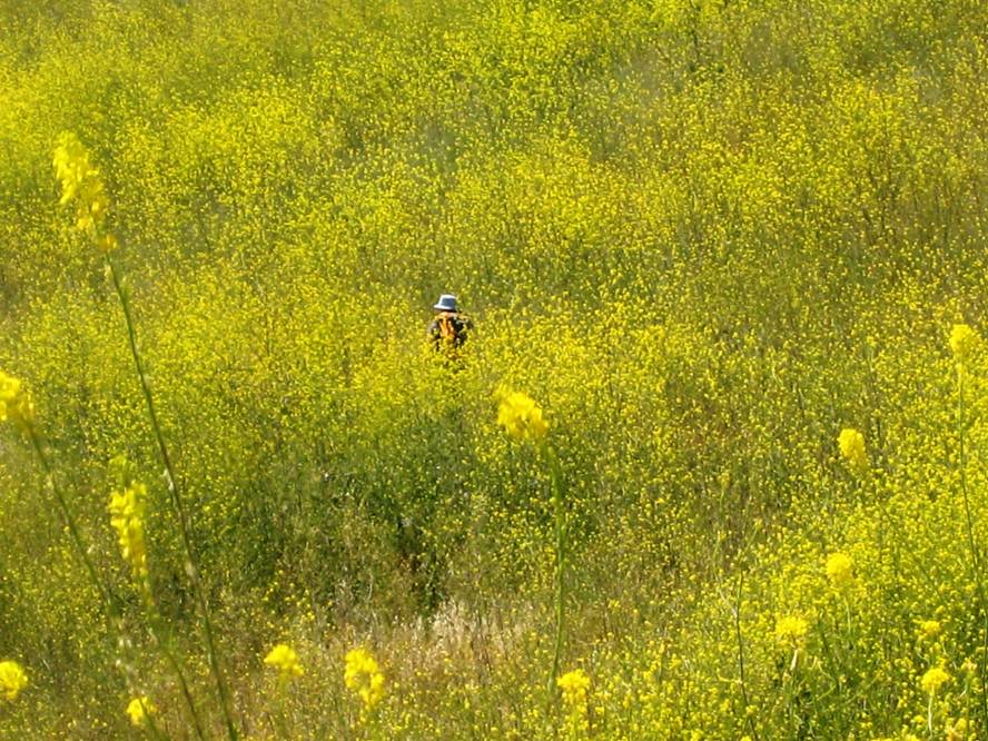
- Fields of wildflowers. (Let’s hope some are still in bloom on hike day.)
- Visit
portals to both coal and sand mines. Peer down the once bustling
shafts.
- Yes – the Hazel Atlas mine supplied sand used for glass making in the 1920s – 1940s.
- The Eureka Slope inclined shaft was the entrance to the Eureka Coal Mine where more than 150,000 tons of coal was hoisted to the surface in the late 1800s.
- Views of the town of Antioch and the Antioch Bridge.
- Countless “trees with character”
- Views of the confluence of the San Joaquin and Sacramento rivers near the town of Pittsburg -- the Delta. This is not to be confused with the confluence of the Allegheny and the Monongahela rivers to form the Ohio river in the real Pittsburgh.
- Cows that will ignore us as we hike by
- And unfortunately NOT the visitor center, which is a huge room 200 feet into a mine shaft that is presently closed for renovation.
Your emotions will include:
- Moments of pure awe as the grasslands spread out ahead. You’ll no doubt be humming “America the Beautiful” as you traverse these trails.
- Deep reflections on days gone by as you put yourself in the shoes of coal miners and the hard lives they lived.
- A sigh of relief as you stay in the Prospect Tunnel and Hazel Atlas mines to cool off in the heat of the day.
- An appreciation for the experience to learn about the history of this interesting part of Northern California that very few of us were aware of.
- Curses for the hike leader as you “hit the wall” on the steep climb at the 5 mile mark (save your energy)
LUNCH: Bring your lunch. A lunch break is planned for mid hike.
TRAVEL TIME / DISTANCE / PARKING: Travel time is approximately an hour and 45 minutes and 102 miles from Lincoln. We will stop for dinner prior to returning home to Lincoln. Suggested contribution for riders is $15. Detailed driving directions will be handed out to all drivers. Note that this is a state park with a $5.00 per car parking fee unless you are in possession of a state park pass. Also the toll on the Antioch bridge when returning to Lincoln is $4.00.
HIKE LEADER / SWEEP: Dennis Ratay / Margaret Ratay
SPECIAL NOTES:
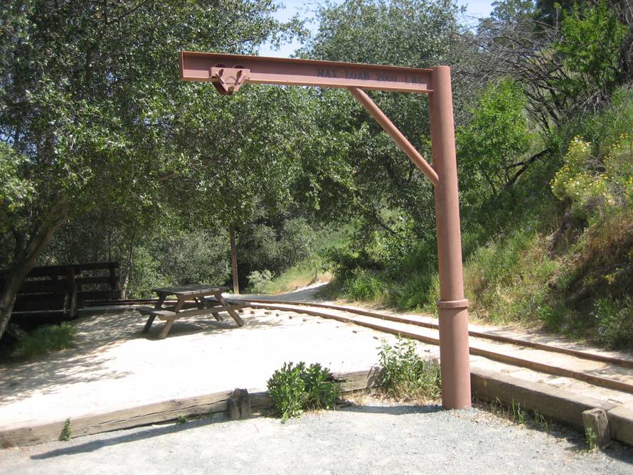
FACILITIES AVAILABLE: A comfort station is available at the trailhead.
PREPARATIONS FOR HIKE: Hiking boots and poles recommended. Shade is limited on many parts of the trail, so bring sun screen, a hat and plenty of water. Did I mention plenty of water? Bring it. Also a flash light is helpful to explore 200 feet into the Prospect Tunnel.
RISKS: One sighting of Poison Oak was noted on the prehike but was off the trail and easily avoided. Also the temperatures could be rising in June, so be prepared for plenty of heat and sun.
QUESTIONS: Call Dennis Ratay at 543-9935.
MEETING TIME: 6:45 am -- Leaving time: 7:00 am in an attempt to avoid some of the afternoon heat.
RAIN CANCELS HIKE
ANOTHER SPECIAL NOTE: In case you are wondering, BLACK DIAMONDS was another term to refer to COAL.
Some pictures from the pre-hike: