Blue Ridge – Cache Creek Wilderness
Tuesday, November 18, 2008
DIFFICULTY: Strenuous
ELEVATION GAIN: Over 2200 feet, starting at 700 foot elevation
HIKE DISTANCE: 7 miles
GENERAL LOCATION: Cache Creek Canyon Regional Park – on SR 16 in Yolo County near the Cache Creek
Casino – 54 miles due west of Lincoln as the crow flies.
DESCRIPTION: This trail in the Cache Creek Wilderness is an
unique experience – quite different from other hikes in our repertoire. The trail rises
(relentlessly) through chaparral and oak forest
toward Fiske Peak.
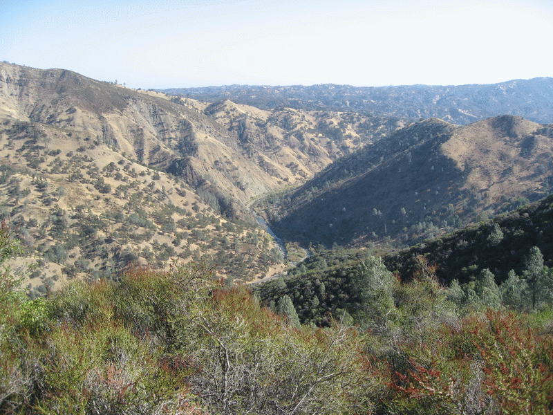
From the trail there are expansive views of Cache Creek canyon and the
Cache Creek Wilderness area. If the air
is clear, one can see into the Sacramento
Valley and the Sutter
Buttes, as well as westward to Mt.
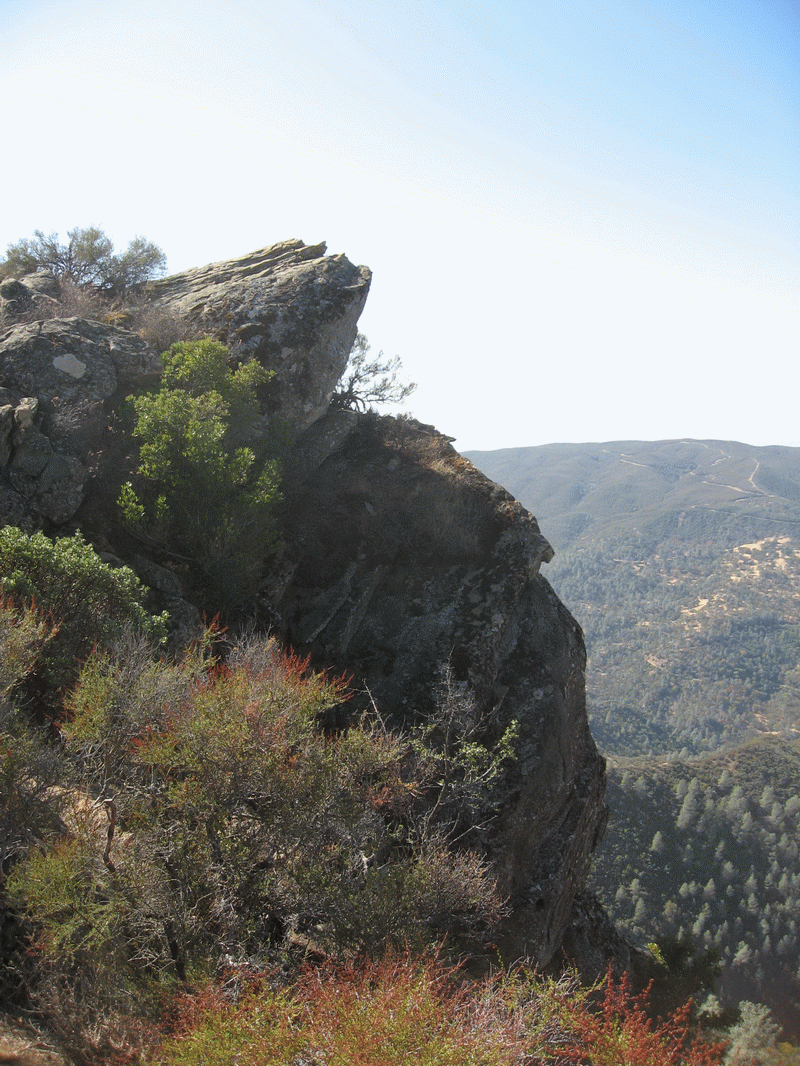
St. Helena. The trail is primitive, is narrow, very
steep, and is crowded by brush and low trees.
In some areas, there is a precipitous drop-off. The result is a challenging hike in an area
where you are not likely to encounter other hikers. We will eat lunch at the top of the Ridge. NOTE: althought the plan is to stop for lunch at the top of the Ridge, some ambitious hikers may wish to extend the hike another mile to the top of Fiske Peak, which is a few hundred feet higher.
TRAVEL TIME/DISTANCE: Approximately 2 hours – 81 miles. Based on the length of the drive, a monetary contribution of $12 for gas would be appreciated - to be given to driver at beginning of drive. Detailed driving directions will be handed out to all drivers. There is a $6 fee for parking in Cache Creek Canyon Regional Park. We expect to return to Lincoln before 5 PM.
HIKE LEADER/SWEEP: David
Wood/TBA
SPECIAL NOTES:
FACILITIES AVAILABLE: At the trailhead.
PREPARATION FOR HIKE: Because of the challenges on this hike, hiking poles
are a must. It would be wise to wear a
hat and sun glasses, as well as long sleeves and long pants, to protect from
scratching by the bushes crowding the path.
Bring a lunch and adequate water.
RISKS: The risks have been pretty well enumerated above: steep, narrow, precipitous, bushy, arid. There is some poison oak, but at least that is not crowding the trail.
WEATHER: Rain will cancel the hike. The trail has some clay areas, and wet conditions from prior rain will also cancel the hike.
QUESTIONS: call Dave or Monique Wood at 408-7562
MEETING TIME: 6:45, leave at 7:00. We will have recently changed to Standard Time, and need to leave early to ensure daylight at the end of the hike.
Photos from the pre-hike
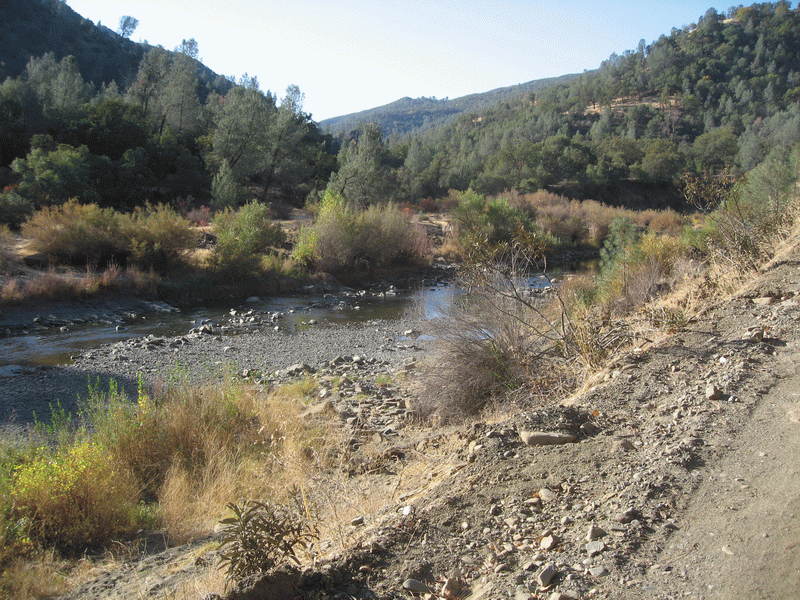
Cache Creek
Cache Creek from the trail
At the top of Blue Ridge