Another Dam Hike
(Auburn Dam Construction Site Hike)
Tuesday, December 2, 2008
DIFFICULTY: Easy to Moderate
(Hike is short and relatively flat but 3 uphill sections contribute to the Moderate rating for some hikers)
ELEVATION GAIN: Trail is relatively flat with a few ups and downs. No significant elevation gains. Starting and highest elevation about 1200 feet – lowest elevation is about 800 feet.
HIKE DISTANCE: 4 ½ miles (Most of the hike is a loop with a couple portions of the trail used to double back.)
GENERAL LOCATION: Auburn State Recreation Area. The trailhead is ½ mile from the center of Auburn.
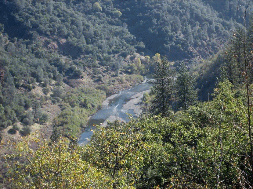
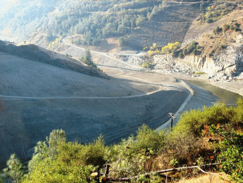
DESCRIPTION: This hike is a great morning outing to enjoy views of the North Fork of the American River and the Auburn Dam construction site as well as the Foresthill Bridge. The American river was restored to its original route in September, 2008 at a cost of $30 million with the closing of its Auburn Dam diversion tunnel. The highlight of the hike is the overlook of the newly constructed 1,000-foot-stretch of rock bed river bottom – a series of pools lined with stone embedded in concrete - that will be used for paddlers as Class III rapids as they paddle from the confluence of the two American River forks down river to Rattlesnake Bar State Park. Construction of the Auburn Dam was halted in 1977 but the preliminary cuts into the canyon walls will linger for a long time and leave a lasting impression on hikers.
LUNCH: Hikers wishing to eat at the Sierra Grill restaurant just 2 miles from the trailhead and just north of Auburn will need to carpool together. Otherwise lunch is not needed, as we should be back at Lincoln Hills shortly after noon.
The Sierra Grill serves breakfast and lunch all day, including “Ultimate Omelettes”, breakfast specials and hot and cold sandwiches. They also have burgers and salads and a SENIOR MENU.
TRAVEL TIME/DISTANCE: Travel time is approximately 30 minutes. Return time to Lincoln Hills is approximately noon unless we stop for lunch at the Sierra Grill. Suggested contribution for riders is $3. Detailed driving directions will be handed out to all drivers.
HIKE LEADER/SWEEP: Dennis Ratay / Margaret Ratay
SPECIAL NOTES:
FACILITIES AVAILABLE: None -- we will use the bathrooms at Orchard Creek before leaving the parking lot.
PREPARATIONS FOR HIKE: Hiking boots or tennis shoes, water and layered clothing, as it will be cool when we start out. Long pants recommended to limit threat of burrs on one section of narrow trail.
RISKS: Poison oak is trailside but is easily avoided.
QUESTIONS: Call Dennis Ratay at 543-9935.
MEETING TIME: 8:30 am -- Leaving time: 8:45 am
RAIN CANCELS HIKE
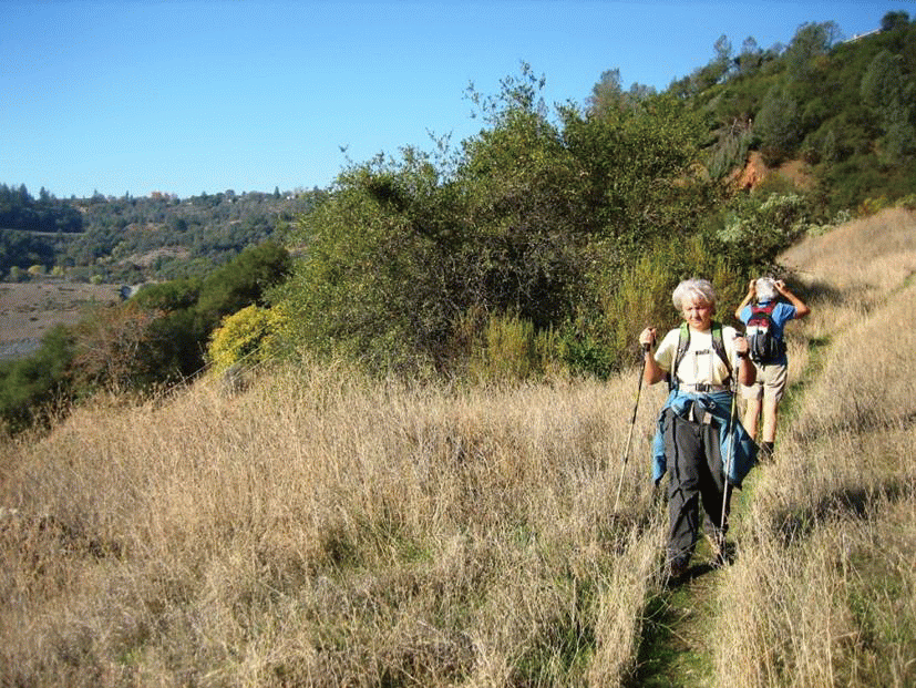
Some pictures from the trail: